Still see the trees for the forest
Where are our largest Black Cherry trees? Where the Oaks with dbh > 20 inches and stemlength > 32 ft. Where do we lack regeneration? What about relative density and optimum growth? This and so much more can be queried with a mouse-click today in GIS (Geographic Information System).
Why then even forest inventories? Well, it is not that easy. The data must be gained first, which is accomplished by forest inventories, also called "cruises".
What are the cruises about? They are about obtaining efficiently and with adequate precision the data needed for ecologically and economically sound forest management.
And how is this done?
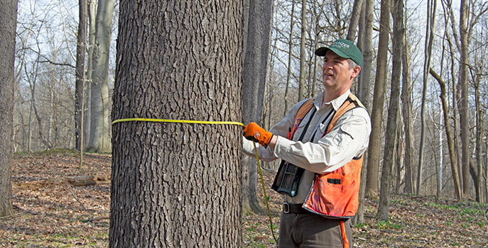
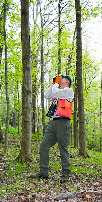
Do we measure every tree? No, that would be too cumbersome and is not necessary. We apply systematic angle-point sampling which was developed by Dr. Walter Bitterlich 70 years ago. Created in Austria, this technique is especially popular in the Northeastern United States. Only those trees are measured which are wider than the defined sampling angle as seen through optical instruments. Big trees are "inside" the virtual plot even when standing in some distance. Small ones only if they stand very close to the point center.
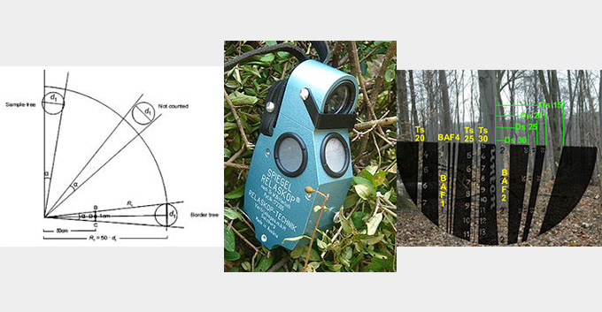
Picture 1: Angle-point-sampling, Picture 2: Spiegel Relascope, Picture 3: View through the Relascope
A quick summary of steps:
- Estimate the number of points needed as to statistical requirements.
- Layout of a systematic grid of sample points.
- Wandering the woods and visiting the plots, made easy with the friendly help of a GPS.
- Measure trees (specie, dbh, length of log, most valuable product, volume discount for defects).
- Run the numbers, extrapolate the data to the area, integrate in GIS
- Creation of specific maps, from Average volume ... to Zoom-ins on maturity. Aerial photos and/or topographic maps are chosen as background. Details such as hill shade and average tree heights can also be added.
- Use of data for silvicultural treatments, harvest and sales planning, cash flow, accounting, Profit & Loss, verification of sustainability....
We prefer to cruise in the winter, during the dormant season, when measurements are more precise and growth simulation can be done for full periods. Also, the GPS has better satellite reception. And we have an improved vista through the optical instruments for the angle-point sampling. With foliage, "the forest does not let you see the trees" (and it is about them at this stage, later re-combined to forests).
As mentioned in one of our previous blogs, we closely follow technical novelties like drones, but also know their (actual) limitations. In Pine-monocultures focused on volume, "fly around" may already be the method of choice. For our mixed forests with big value differences between as well as within the species, however, a go and see approach remains the name of the game until further notice. And just between you and me: Luckily! Terrestrial Forest Inventories, boosted with warmly welcomed high-tech-help, harmonically combine business with pleasure!
Illustrations:
Kramer H. and A. Akca. 1995. Leitfaden zur Waldmesslehre. 3rd edition. J.D. Sauerländers Verlag, Frankfurt. 266p
Spiegel Relaskop by Feinmechanische Optische Betriebsgesellschaft Salzburg
To subscribe to this blog copy the following URL to your feed reader: http://www.danzer.com/en/company/media-relations/danzer-blog/feed/rss/blog?format=feed
About the Author

Project Manager Danzer Forestland
Hermann Hampel was investigating the dynamics of native forests in Argentina before joining Danzer there in 1998. He managed the afforestation project with high value hardwoods in the province of Misiones until 2012 and thereby applied innovative techniques like mixed plantations, natural regeneration and shelter-wood planting. Today he works on the optimization of Veneer Production and Forest Management for Danzer in North America. Among others, in order to still see the forest for the trees, he converted vast amounts of data from Forest Inventories into a compact GIS. He lives with his wife and two children in Ohio, USA.